

The Carefree / Cave Creek Aquifer Basin is a two part aquifer divided by an underground rock uprising in the vicinity of Scopa Trail. The sub-basin to the west services most of Cave Creek. The sub-basin to the east services Desert Mountain and Carefree. In the past, due to over pumping of the aquifer, the water levels dropped precipitously to a level that would be unable to support the long term water needs of Carefree.
With the purchase of the Water Company, the purchase and use of additional CAP water thus reducing the amount of groundwater being pumped from the aquifer and the addition of a recharge facility by the City of Scottsdale just east of Pima Road, the aquifer has begun to recover.
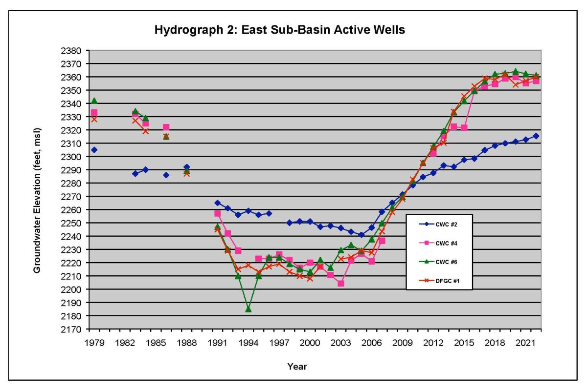
As the Hydrograph indicates water levels in the east basin of the aquifer since the purchase of the Water Company have leveled off and in the past two years underground water levels have increased approximately 10 to 15 feet per year. Carefree Water Company since the purchase of the Water Company has reduced its groundwater pumping from approximately 1,200 A.F per year to about 350 A.F. per year.
Scottsdale has also reduced pumping from the aquifer.
 Groundwater Hydrograph 1979 to 2022